Wednesday, December 29, 2010

What's with the bluish lighting on CTA buses?


by John Greenfield

[This article also runs in Time Out Chicago magazine, www.timeoutchicago.com.]

Q: What’s up with the weird blue lighting inside CTA buses in the past year or so (and now in some CTA train cars as well)? It looks like if you took some dirty combs in there, they’d come out clean! — Joe Bogdan

A: That bluish glow inside some buses and trains comes from new LED lighting that has replaced fluorescent bulbs, according to CTA spokeswoman Wanda Taylor.

In fall 2009, the agency added 58 articulated hybrid buses, bankrolled by federal stimulus money. The new vehicles are less polluting, quieter and a smoother ride than conventional buses, and the new LEDs on these vehicles are a greener, lower-maintenance choice since there are no bulbs to change, Taylor says.

This year the agency has also been testing interior LED lighting on its rail system, although the higher cost of the LEDs and difficulty keeping a steady voltage on the trains may prevent them from changing the lighting system-wide.

The CTA is also considering adding color-coded LEDs on the outsides of train cars, Taylor says, so that when you’re standing on, say, the Fullerton platform it will be obvious whether a particular train serves the Red, Brown or Purple Line.

Thursday, December 23, 2010

Rough ride: the transit agencies tighten their belts


By John Greenfield

Photos by Gilbert Feliciano

[This article also ran in New City magazine, www.newcity.com.]

On an icy Monday night a handful of citizens has braved to cold to visit the Loop office of the Regional Transit Authority, which sets the budgets and provides oversight for CTA, Metra and Pace. They’re here for the last of several public hearings on the RTA’s 2011 financial plan. Several of the attendees are transit activists who show up regularly for these kind of meetings. There are also a few people with disabilities here, and there’s a sign language interpreter at the front of the room.

Joseph Costello, the RTA’s mild-mannered executive director, starts the hearing by explaining how the sour economy has impacted the three transit agencies. Reduced consumer spending means the RTA’s largest source of public funding, a 1.5 percent cut of Cook County sales tax receipts plus .5 percent of receipts from the five collar counties, dropped from about $750 million in 2007 to roughly $650 in 2010. Meanwhile, the cash-strapped state government has been delaying its payments to the RTA, making it tough for the transit oversight body to pay its own bills.

Joseph Costello

In response to these funding problems Costello says CTA, Metra and Pace are making financial sacrifices. 2011 budgets are smaller, there have been over 1,000 employee layoffs and, like eighty percent of transit agencies around the country, they’ve cut service and hiked fares. On the bright side, while regional transit service has been reduced by three percent, ridership is only down by one percent, he says.

Although the three agencies will have smaller capital budgets next year, Costello says the RTA is studying the condition of tracks, stations and other infrastructure for future improvements. “The engineers tell us if we were to rebuild our regional transit system from scratch it would cost us $52 billion, so it’s a valuable asset we should invest in and preserve,” he says.

When the floor is opened to comments Heather Armstrong, who uses a wheelchair, argues that Metra and Pace offer cleaner buses and trains, and better customer service than CTA. “You should give the CTA train system to Metra and the bus system to Pace,” she says.

Charlie, a senior with a crew cut who’s a member of the transit workers union and the transit advocacy group Citizens Taking Action says he’s worried about future layoffs. “The union drivers ain’t got no contract,” he says. ‘Will there be three, four, five thousand more layoffs next year?”

The City of Evanston’s Matt Swentkofske says, “Evanston is very blessed to be served by CTA, Pace and Metra.” He asks Costello for help getting three rail viaducts rebuilt in the village. “Let us know what kind of lobbying we can do.”

Kevin Peterson, a young man in fatigues and combat boots who says he’s with the group Citizens Against Terrible Transit Service, rants against faulty fare cards, bus drivers who refuse to lower access ramps, and the RTA’s efforts to end the free rides for seniors program. “You guys are supposed to make sure CTA, Pace and Metra get along,” he says. “You’ve been deadbeat parents.”

Saturday, December 11, 2010

Give a Minute wants your car-free travel ideas


By John Greenfield

Ever wish you could stick a Post-it note on the computer screen of an influential city planner with your idea about how to make it easier to walk, bike or use transit in Chicago? The Give a Minute campaign gives you a chance to do just that.

Launched in Chicago on November 2 by CEOs for Cities, an urban planning think tank, the campaign allows citizens to share their ideas for improving car-free travel with the public as well as key leaders in the city’s green transportation scene. These suggestions appear as colorful notes on the website www.giveaminute.info. You can post your ideas on the website or text them to 312-380-0436 until December 10.


A quick look at the Post-its on the website provides fast food for thought, ideas for better biking, walking and transit in a format that makes Twitter seem long-winded. “Make sure heaters are working at all stations,” says one post. “Chicago winters are brutal.” “Free or reduced-price bike maintenance and basic repair classes,” says another. I posted, “Better-marked crosswalks, and more enforcement of laws requiring drivers to stop for pedestrians in the crosswalks.”

On December 8-10, CEOs for Cities and the Chicago Architecture Foundation will host the Connectivity Challenge, a conference bringing together national urban planning experts and local transportation and planning agencies to discuss the best of the car-free transportation ideas harvested from the website. According to the organizers, the goal of the symposium is to produce new ideas and “quick start” strategies that will be promoted in book form, through a promotional tour and as a national policy platform.


I called CEOs for Cities communication director Natalie Campbell for details about the project.


What is the campaign all about?


We worked with a company out of New York called Local Projects to develop this campaign. The idea was public engagement through technology. The campaign is launching in Chicago and we’ll take it to other cities as well, including Memphis, San Jose and New York.

In Chicago the idea is to start a public dialogue about how we can make it easier to get around the city without a car. The CTA is a sponsor of the campaign, so we have about car card ads in CTA buses and trains. We’re promoting the campaigning the campaign throughout the city, asking, “Hey Chicago, what would encourage you to walk, bike or take CTA more often?”

We worked with Terry Peterson, the chairman of the CTA, Ron Burke with Active Transportation Alliance and Stan Day with SRAM [a Chicago-based bike parts manufacturer] to be our faces of the campaign, our “response leaders.” They’re the people asking that question to citizens.

So we launched the campaign about two weeks ago and so far we’ve had over 500 responses and they’ve all been really good responses. We’re pretty excited about the campaign. We’re compiling all these recommendations and saying, what are the common themes here? Then we’re holding an event December 8th through the 10th called the Connectivity Challenge.

That event will together nine national experts on transit mobility and accessibility and a group of local stakeholders which includes some of the local stakeholders: the CTA, Active Transportation Alliance, the Regional Transportation Authority, CMAP [Chicago Metropolitan Agency for Planning, Metra, the Chicago Department of Transportation. It will bring all those people together to explore this ambition of a future where Chicago residents can get around more easily without a car.


So you’re collecting all these ideas, all these electronic Post-it notes. How will these ideas guide the recommendations of the Connectivity Challenge?

The format of this event is the local stakeholder teams are going to present existing projects and goals for the future. This national team is coming to town with a fresh eye and a different perspective. They’re going to be working hard and working fast over two and a half days to explore what we call “twelve big ideas.” We’ll take the citizens’ responses and narrow them into the categories of biking, walking and CTA.

So if someone is saying “more bike lanes” we’re letting the local and national experts know this is what we’re hearing from the people. We’ll think about how we can turn these recommendations into big ideas, whether it’s infrastructure or policy recommendations.

What is a “quick start strategy”?


A quick start strategy could be something small, like Chicago businesses setting up bike training programs for their employees. For example, Active Transportation alliance has people who go into companies and say, “Don’t be afraid to ride your bike to work – here’s some easy tips on how to navigate around the city.” Because a lot more people are biking now but it’s still a segmented audience. So if you can reach out to other people and make them not as wary of riding their bikes, then you’re expanding ridership.

I was at a meeting where we were discussing other quick start ideas and one of them was making sure people have bike racks at their offices because a lot of people have trouble parking their bikes when they get to work. Or at the el stops, making sure that there are bike racks there. Because when we’re talking about connectivity it’s not just not just biking or walking. You can ride your bike to an el stop, jump on the train and get to work, but you need to have a bike rack at the el station.

So what are you guys hoping to achieve with this campaign?


The big ambition is to create a future where it’s easy to get around Chicago without owning a car. In the short term, people are always looking for ways to be engaged and this program is a way for citizens to talk back to their city and having them feel like they have a say in it. We really are connecting them with change-making leaders. Terry and Ron and Stan are responding directly to some of the best recommendations. And there really are a lot of great recommendations on the site.

So we’re bringing those ideas to our national, or international, expert team. We have Jan Gehl from Denmark who’s one of the world’s foremost urban planners and architects. So you really do have a say. And that’s the challenge people have, feeling that they really are able to help create change, so programs like this help people feel like they can make a difference.

Saturday, December 4, 2010

Citizens sound off on the CTA's 2011 Budget


By John Greenfield

[This article also runs in New City magazine, www.newcity.com.]

It's Tuesday evening at the Chicago Transit Authority’s headquarters, 567 W. Lake, and a few dozen citizens file through the lobby with its life-sized cow sculpture, plastered with photos of CTA stations, then up the stairs and past a 3D neon rendition of an “L” train zooming by skyscrapers. They’re here to offer their two cents on the agency’s proposed $1.337 billion budget for 2011 at one of four public hearings being held across the city.


Last winter the transit authority tightened its belt by cutting nine express buses, reducing service hours on 41 bus routes, and providing less-frequent service on 119 buses and seven of the eight rail lines. The goal for 2011 is to hold the line on fare increases and service reductions, despite the bleak economic picture.

This new budget is actually 5.2 percent larger than last year, partly due to pay raises, healthcare and pension costs required by the agency’s contract with its union workers, according to management. “Balancing the budget was very challenging this year,” says CTA president Richard L. Rodriguez in a press release. “Nevertheless, the CTA expects to accomplish a great deal in 2011 and it will do so by being resourceful and innovative.” On the plus side, next year the agency will be adding new, smoother-running rail cars to the system and debuting a “Train Tracker” service.

At the hearing, as folks take turns stepping up to a microphone to have their say, Rodriguez and the CTA board members sit stoically at the front of the room, showing no emotion even when confronted by the more eccentric and irate speakers. The attendees are a racially mixed, blue-collar crowd, including several non-union employees who lost their jobs in the last round of cuts, wearing “Laid-off CTA worker” t-shirts.

“It’s good that we’re having no further reductions in service or increases in fares,” says transit activist Les Slater. “But we’ve already had reductions and increases, and there’s plenty of money to go round. When the banks need cash they get a bailout, but the majority of people served by the CTA don’t have political power – they need to organize.”

Laid-off CTA mechanic Ricky Anderson tells the board he’s anxious to turn a wrench again and frustrated to see recent job openings at the garages go unfilled. “I’m praying that when you get the money you’ll re-hire the workers,” he says. The meeting facilitator takes down his number and promises to have the HR department call him.”


A woman describes how a non-employee was somehow able to steal a bus from the 103rd Street garage and pick up passengers and argues that if the public was allowed to monitor the CTA’s security camera system it might be easier to stop crimes in progress. “It really takes a lot of eyes to see what’s going on in the system,” she says.

Lawrence Msall, president of the Civic Foundation, a tax policy and government research organization, recommends repealing Blago’s free rides for seniors program. “We’re losing $25-70 million a year in revenue and it will only get worse as the population ages,” he argues.

George, a wild-eyed, slightly disheveled man who’s a regular at Cook County board meetings, takes the mic to complain about the relatively low attendance at this hearing due to the out-of-the-way location. “It’s appalling,” he says. “When these meetings were at the State of Illinois Center there used to be hundreds of people lined up to get in.” He keeps ranting about other topics well after his allotted time runs out and the facilitator sternly asks him to step down. George turns to the audience and says scornfully, “I think they deliberately try to distract me when I speak.”

Friday, December 3, 2010

Celebrating the launch of the GO TO 2040 plan


Local leaders party like it's 1909 at the launch of Chicagolands’s first major urban planning blueprint since Burnham

By John Greenfield

[This article also runs in New City magazine, www.newcity.com.]

It’s pouring, but that doesn’t dampen the spirits of a thousand sharp-dressed politicians, urban planners and other civic leaders crammed into a tent on top of Millennium Park’s Harris Theater. They’re here to launch GO TO 2040, a blueprint for making tough development and spending choices in the Chicago area’s 284 communities, for the next few decades and beyond.

The Chicago Metropolitan Agency for Planning (CMAP) will lead the implementation process, and stakes are high. As the region’s population balloons from its current 8.6 million to an estimated 11 million by 2040, the decisions we make now will determine whether Chicagoland becomes more prosperous, green and equitable or devolves into a depressed, grid locked, smog-choked dystopia.

The plan, developed by CMAP its partner organizations over three years and drawing on feedback from over 35,000 residents, includes the four themes of Livable Communities, Human Capital, Efficient Governance and Regional Mobility. It makes detailed recommendations for facing challenges like job creation, preserving the environment, housing and transportation.

Banners at the launch party feature GO TO 2040’s cover image, an Aurora-centric aerial view of the region, with expressways and transit lines radiating from Chicago like bolts of lightning. Considering that this is a plan for future generations, affecting people from all walks of life, it’s odd that almost everyone on the stage is an older, white male in a dark suit.


CMAP board chairman Gerry Bennett, mayor of Palos Hills, kicks off the proceedings by comparing the occasion to the 1909 release of Daniel Burnham’s “Plan of Chicago,” which helped create a city with plentiful parks and preserved the lakefront for public recreation. “When Burnham proclaimed ‘Make no little plans,’ he asserted that as a great metropolis we have the ability to reach for the unreachable,” Bennett says.

Senator Dick Durbin highlights the importance of local leaders working together to improve the region, and he warns the crowd that implementing GO TO 2040’s strategies during the current financial woes is going to take grit and perseverance. “We have one thing on our side,” he says. “A president who loves Chicagoland as much as we do.”

Senator Durbin, seen two days later listening to blues at Rosa's

WTTW’s Geoffrey Baer moderates a panel discussion on the urgency of long-range planning and the economy that includes a fired-up Mayor Daley, wearing his trademark scowl. Daley says Chicagoans, and Americans in general, need to be more optimistic about our future. “Until we get our confidence back other countries will look at us as whiners.”

Michael Moskow from the Chicago Council on Global Affairs argues higher road tolls and parking fees are needed to reduce car dependency. “As you raise the cost of driving and make transit more attractive, more people will make the shift.” But George Ranney, head of the pro-business organization Metropolis 2020, scoffs, “Some of my friend’s radical ideas are not actually in the plan.”

Baer closes the discussion by recalling the words of businessman Charles Wacker upon the publication of the Plan of Chicago: “This will be remembered 80 years later as the day that gave Chicago the most beautiful lakefront in the world.” Today’s launch of GO TO 2040 is a similar occasion, Baer says. “Many of the people here today won’t live to see the results, but we can hope for them.”

A tale of two road diets

The road diet pilot in Humboldt Park (posed photo)

New “road diets” aim to beef up safety by slimming down streets, but will bicyclists get their piece of the pie?

by John Greenfield

[This article also appears in Time Out Chicago magazine, www.timeoutchicago.com.]

Cities across the country are seeking to improve safety through the so-called road diet—narrowing or removing street lanes to calm traffic and create more space for pedestrians and bicyclists. “A major benefit is reducing vehicle speeds and focusing attention on the other public-way uses,” says Chicago Department of Transportation (CDOT) spokesman Brian Steele.

Now the city is planning to give Lawrence Avenue in Lincoln Square and Humboldt Drive through Humboldt Park a traffic tummy tuck. “It’s a shift in the way [the city is] thinking about streets,” says Active Transportation Alliance’s Adolfo Hernandez. “The aldermen for both projects have been very supportive. Taking away a lane of traffic is not easy to do—it takes political will.”

The $12 million Lawrence streetscape project, tentatively scheduled to start next year, stretches between Western and Ashland Avenues and will slim the avenue from its current four travel lanes to one lane in each direction with a center turn lane, Steele says. This “four-to-three conversion” will provide space for wider sidewalks, curb bump-outs, pedestrian refuge islands and new bike lanes.

This is what Lawrence currently looks like.

This is what Lawrence will look like after the road diet is implemented.

The streetscape also will provide more space for sidewalk cafés and make it easier to pedal to the lake, says Dan Luna, 47th Ward chief of staff. “Lots of people have been contacting our offices requesting safer bike routes,” he says.

Eric Holm, manager of On the Route Bicycles (2338 W Lawrence Ave), applauds the change. “Lawrence is pretty intimidating for beginning riders,” he says. “Adding bike lanes means more people will be riding past our store and shopping here.”

The Humboldt Park road diet is proving to be a bit more controversial. Since August 23, CDOT has been working on Humboldt Drive from North Avenue to Division Street, the high-speed roadway dividing Humboldt Park. It temporarily changes the four-lane street into two travel lanes with a center lane used as a combination left-turn lane and pedestrian refuge area, using orange traffic barrels to keep moving cars out of the center lane. After CDOT analyzes the effects on traffic speed and behavior, Steele says, the changes may become permanent next year.

Roberto Maldonado, 26th Ward alderman, helped push for the project after his office received many complaints about speeding traffic and difficulty crossing the street, says Maldonado’s chief of staff, Kathleen Oskandy. “A lot of them were from young moms with baby strollers,” she says. Although residents proposed adding stoplights, stop signs and speed humps, Oskandy says federal constraints on the historic boulevard limited those options.

Not everyone is enthusiastic about the experimental setup, which, unlike the Lawrence road diet, does not include the addition of bike lanes. Oskandy says there was initial talk of including them, “but the first plan of attack was to slow down the traffic, so bike lanes might have added to the confusion.”

Drivers we talked to felt comfortable with the new configuration, but cyclists didn’t. During a half-hour period on a recent Tuesday afternoon, a handful pedaled on the asphalt paths that run parallel to Humboldt Drive, but no one attempted to ride in the newly slimmed street. “I’m a little afraid to bike in the street now,” said Jim Stablein, 58. “Cars can’t squeeze by you.”

Jim Stablein (posed photo)

Although the city-issued Chicago Bike Map designated this segment of Humboldt Drive for years as a cycling-friendly street, CDOT removed it from this year’s edition, recommending a stretch of nearby Kedzie Avenue as the safer route. As a result, the two-mile stretch of Humboldt (called Sacramento Boulevard south of the park) between Armitage Avenue and Franklin Boulevard is virtually the only segment of Chicago's 28-mile historic boulevard system that is not recommended as a bike route. Since Humbolt is no longer a recommended route, it's not under consideration for bike lanes, says CDOT bikeways engineer David Gleason.

That’s unfortunate, says Todd Gee, president of the nonprofit alt-transportation org Break the Gridlock. “The new travel lanes aren’t wide enough for cars to safely pass bicyclists. It’s fantastic they’re doing something about speeding and making it more pedestrian friendly, but it’s disappointing that they’re not accommodating bikes.”

Ash Lottes, who takes her son to pre-school by bike via the park, says she met with Maldonado on September 21 to discuss the possibility of adding bike lanes and sidewalks along Humboldt. She provided the alderman with blueprints for alternate street configurations that would include bike lanes.

“He told me that he has no intention of adding a bicycle lane or any other accouterments on that stretch because ‘the road is too dangerous for pedestrians,’” she says. Lottes recently posted on the local bike website thechainlink.org, asking members to lobby Maldonado for bike lanes on Humboldt. “To me the road seems too dangerous for pedestrians because there are no sidewalks, crosswalks or bike lanes.”

Going Dutch at the ThinkBike symposium


By John Greenfield

[This piece also runs in New City, www.newcity.com.]

On a balmy Wednesday morning, bike racks outside the Thompson Center are clogged with cycles. The drum-shaped building is nicknamed the “Tom Tom” by messengers who chill in the plaza while waiting for work. But today a cleaner-cut crowd has pedaled here in suits and skirts for the ThinkBike symposium, “a Dutch boost to Chicago’s bike-ability.” Naturally, the collection of cycles includes elegant Dutch city bikes and hardworking bakfiets (“box bike”) cargo vehicles.

The workshops, sponsored by the Dutch Consulate General and Active Transportation Alliance, bring bike transportation specialists from the Netherlands together with their Chicago counterparts to brainstorm ways to make our city the Amsterdam of the Midwest. Rather than legalizing pot and prostitution, the goal is to bump our city’s measly one-percent bicycle mode share closer to the utopian standards of Holland, where 27 percent of all trips are made on two wheels, and there are more cycles than citizens.

The visitors from the Netherlands are stylishly dressed in sports jackets and Beatle boots, and most of them are freakishly tall. In the afternoon these flying Dutchmen will pedal their fietsen around town with local politicians, transportation planners and bike advocates, discussing ways to create safer, more appealing streets for cycling.

Active Transportation Alliance's Adolfo Hernandez

Emcee Geoffrey Baer, host of WTTW’s November 29 special “Biking the Boulevards,” kicks off the session with a discussion of our town’s rich bike history. “In the 1890s Chicago was the bicycle manufacturing capital of America,” he says. “Two-thirds of American bicycles were made in the region.” It turns out Richard J. Daley wasn’t the first mayor to push pedaling here – in the 1897 mayoral campaign Carter H. Harrison II coasted to victory with the campaign slogan “Not a Champion Cyclist; But the Cyclist’s Champion.”

Hans Heinsbroek, Consul General of the Netherlands, takes the podium and boasts that his country has 13,000 kilometers of bike paths, tens times more than the total length of highways, noting “The bicycle is the cleanest, most sustainable form of urban transportation.” Heinsbroek says Baer has asked him to read the guttural-sounding names of the other Dutch speakers. “Because, you know, Dutch is not a language but a throat disease.”

Hans Voerknecht, a sustainable mobility consultant, contrasts American and Dutch attitudes towards biking and driving. While most while most kids in Holland bike to school, many U.S. principals forbid their students to pedal to class. “People say the car is the symbol of American freedom,” he says. “But I don’t feel free when I’m sitting in a cage, stuck in traffic.”

Bike policy expert Arjen Jaarsma offers encouragement to Chicagoans who feel that promoting cycling is an uphill climb. He shows a graph illustrating how Dutch cycling dropped off sharply with the rise of car culture after World War II and has only recently recovered to its current levels, after lots of hard work.

Jaarma shows a YouTube video of shiny, happy people navigating the Dutch capital on two wheels and he points out that no one is wearing a helmet. “Bicycling is so normal and the infrastructure is so good there’s no need for them.” The clip features a bumping rap soundtrack: “Step on your pedals and listen to the mic / This is Amsterdam and this is my bike.”

What's going on with CTA Train Tracker?


by John Greenfield

[This article also runs in Time Out Chicago magazine, www.timeoutchicago.com.]

Q: Just curious—when you map a train station on Google Maps, you can click on the station icon and get a pop-up with train colors and times for next trains. Are these times legit and based on GPS of real-time trains, or is it just copying a scheduled map from some other source? —Joel Cornfeld, Lakeview

A: Don’t bet on Google’s pop-up train times being the gospel truth if you’re trying to make a flight.

The departure data that appears when you click a Chicago station icon, a blue square with a train symbol for Amtrak and Metra or an “M” for the Chicago Transit Authority, comes from those agencies, says Google spokesman Jake Parrillo.

While the CTA’s Bus Tracker does provide real-time, GPS-based bus schedules, the El times listed on Google Maps reflect the same static timetable info posted at the train stops, says CTA spokeswoman Catherine Hosinski.

The good news, Hosinski adds, is that the CTA is “currently performing some external tests of a ‘Train Tracker’–type program out on the system using some of the platform LED displays.” There’s no ETA for the formal Train Tracker launch, and the CTA isn’t announcing the pilot program locations.

But if you’re curious, you can see them at the Fullerton and Belmont stops on the Brown, Purple and Red Lines, the Cermak/Chinatown Red Line stop, the Chicago Brown Line stop, the Clinton stop on the Green and Pink Lines, and the Polk Pink Line stop.

Exploring Lake Calumet on two wheels

Lake Calumet viewed from above

By John Greenfield

[This article also appears in Time Out Chicago, www.timeoutchicago.com.]

Airplane passengers looking down at Chicago might notice Lake Calumet, a sculptural body of water that vaguely resembles Hüsker Dü’s classic circle-and-bars logo. Situated at the junction of the Calumet and Little Calumet rivers, it’s home to the city’s main commercial harbor and dozens of birds, including endangered species. But since the lake is ringed by landfills, many locals don’t know it exists. I spent a day exploring what this mysterious South Side lake has to offer from outside its razor-wire border.

After toting my bicycle onto the Red Line, I disembarked at 95th Street and pedaled a few miles southeast to the entrance of Port of Chicago’s Lake Calumet terminal, 130th and Stony Island Ave. The industrial network stretches several miles and is the Great Lakes’ largest general cargo port, handling “lakers,” Mississippi River barges and 1,000-foot oceangoing “salties.” Although it used to be a popular school field-trip destination, the harbor has been off-limits to the public since September 11.

I cycled north on Doty Avenue to Harborside International Golf Course, 11001 S Doty Ave. This treeless, links-style course, built atop mounds of construction debris on Lake Calumet’s northwest shore, boasts a huge Frank Lloyd Wright–inspired clubhouse with tranquil lake views.


I continued south on Stony Island Avenue along the eastern shore of the lake and noticed purple flowers, prairie grass and sunflowers by a small pond. The Southeast Side was once a receptacle for much of the city’s trash, and this ridge of the Paxton Landfill (122nd St and Stony Island Ave), formerly an industrial-waste dump, rises 170 feet high. By 1999, decomposition had made the mound unstable, and it was feared that 300,000 cubic yards of toxic sludge would slide onto Stony Island Avenue. When workers dug a trench east of the landfill to drain and stabilize it, poisonous fumes forced them to wear oxygen masks, and they nicknamed the trench the Valley of Death.

Sunflowers near Lake Calumet

I pedaled east on 122nd past the now-green ridge and south on Torrence Avenue, past the Ford Chicago Assembly Plant and into the Hegewisch neighborhood to eat at Tom’s Truck Stop, 2701 E 130th St, a favorite of port- and autoworkers. The shack contains only a handful of vinyl booths and counter stools. Sinatra crooned from a boom box. Three generations of Hegewisch women kibitzed while I munched a chopped-steak hoagie.

Tom's Truck Stop

Continuing south on Torrence, I rolled past Hegewisch Marsh, future site of the $13.5 million Ford Calumet Environmental Center, 13000 S Torrence Ave. This LEED-platinum structure will house exhibits on the natural, industrial and cultural history of the region. It will also serve as a headquarters for environmental cleanup efforts, tirelessly promoted by education non-profit the Southeast Environmental Task Force. The Studio Gang Architects’ design, called Best Nest, includes a porch wrapped by a basket-like mesh of locally salvaged steel, a place to observe animals and birds.

Hegewisch Marsh

Ready to check out a different kind of wildlife, I rolled west on 136th Street to Papi Chulo’s Bar & Grill, 13601 S Calhoun Ave. Loosely translated as sexy daddy’s, the bar is a Parrothead pub with a Spanish accent. Outside, umbrella-topped tables overlook boats, a sand volleyball court and a stage for live music and DJs. Inside, the decor includes a mermaid figurehead, bathrooms labeled “buoys” and “gulls,” and a life-size statue of a buxom lady buccaneer. As I biked back north, I looked forward to a greener future for the Lake Calumet area, but I hope it keeps its rough edges.


Papi Chulo's

Not pedestrian: looking back at some epic walks


By John Greenfield

[A version of this essay also runs in Time Out Chicago, www.timeoutchicago.com.]

A spider web of orange highlighter on a beat-up old map illustrates my obsessive project to hike all the major streets within the city limits. Since 1999 I’ve walked Milwaukee, Halsted, Archer, Grand, 63rd, Kedzie, Belmont, 79th and Western, the granddaddy of them all at 24.5 miles. These treks always lead me to goofy landmarks, tasty grub, cozy dive bars and friendly folks, and I notice details I’d have missed using faster modes, so traveling slow has taken me far.

Strolling the streets appeals to me more than an afternoon at the Art Institute, where I’d never find a masterpiece like the mural of Jesus as Snoop Dogg outside Gresham’s Liberty Temple Full Gospel Church, 2233 W. 79th.


The giant wieners at Superdawg are well-documented, but few Northsiders know about their fiberglass cousin at Don's Hot Dogs, 7748 S. Kedzie in Ashburn. He’s draped in Old Glory and applying (gasp!) ketchup to his own head. And the neon sign at Rainbow Motel, 7050 W. Archer, beckons me to spend a night of romance in one of their Pink Palace whirlpool suites.


Most of the excellent mom-and-pop eateries I’ve stumbled upon don’t appear in guidebooks. The Terminal Snack Shop, next to the bus turnaround at 7030 W. Grand in Mont Clare, makes a mean bacon, egg and cheese sandwich. At Aguascalientes Carniceria, 3132 W. 26th in Little Village, I got the best gordita ever – a thick disk of grilled masa stuffed with pork loin in red adobo, beans and cheese. I fueled up at Stan and Helene's, 5960 W. Archer near Midway Airport, with a delicious lunch of grilled Kielbasa, a potato pancake and applesauce on Polish Constitution Day.


Ducking into random taverns often makes for an interesting fish-out-of-water experience. Inside Foremost Liquors, 3210 N. Cicero in Craigin, I tipped back an MGD with a room full of men from a nearby SRO. At Woodlawn’s Kozy Korner, 461 E. 63rd, ex-Defender gossip columnist Cliff Pierce bought me a High Life and shared his theory that Obama’s election would turn this depressed neighborhood into a hotspot. And at Ruta 66, a salsa club at 6600 S. Kedzie in Marquette Park, the Nicaraguan barmaid fixed me a refreshing michelada and listened patiently while I hacked through the conversation en español.


I’ve crossed paths with many characters I’d never have met otherwise. A few were jerks, like the teen who spat near my feet as I walked past the crowd outside an Englewood hoagie shop, or the old man behind the counter at Mr. Shrimp, 7157 W. 63rd in Clearing, who yelled at me when I asked him twice for hot sauce. But I’ll never forget Frank White, a blue-collar guy riding a beach cruiser in Back of the Yards on a frigid day who asked for computer tips and told me about training his pet Rottweiler. And I’ll always remember the raven-haired beauty who mesmerized my pal Jonathan when we crossed paths with her on Belmont in Avondale. "You can always tell the Polish women," he sighed. “They have such fine features.”


Frank White

Leaving the neighborhoods I usually frequent to explore these communities on foot has helped keep life in Chicago fresh for me after living here more than two decades. When it’s time to shake things up I look at the spaces between the orange lines on my map and think about which street I’ll walk next. Hmm… Pulaski?

To Milwaukee on trails with the Fat Tire guys

Re-hydrating at Kenosha's Rendez'vous tiki lounge

By John Greenfield

I’ve cycled from Chicago to Milwaukee, mostly on highways, a dozen or more times. But recently I made the trip over two days using a route that is 80 percent off-street paths. I was encouraged to slow down and enjoy the ride by some laid-back, fun-loving dudes from New Belgium Brewing, makers of Fat Tire beer.

The guys were in town to stage the brewery’s Tour de Fat festival, a celebration of bicycles and beer that travels to a dozen or so bike-friendly cities. All the proceeds from beer and merch sales go to local cycling non-profits, in this case West Town Bikes / Ciclo Urbano, a community bike shop and education center in Humboldt Park, which received $20,000 this year.

Bike parade at the Tour de Fat

This year’s Chicago event in Palmer Square Park started with a raucous bicycle parade around the community. The carnival included performances by the local “circus punk marching band” Mucca Pazza and like-minded out-of-towners, a corral full of freak bikes to test ride, and the opportunity to trade your car for a shiny new Black Sheep bike, built in New Belgium’s hometown of Fort Collins, Colorado.

Mucca Pazza at the Tour de Fat

Michael, Brian and Andrew from New Belgium were interested in pedaling to Milwaukee, the next stop on the tour, and West Town’s Alex Wilson tapped me to serve as their Sacajewea, guiding them across the Cheddar Curtain. The guys wanted a leisurely, low-traffic ride broken up over two days, since none of them had much touring experience.

I decided we’d stick to the route outlined in Peter Blommer’s Biking on Bike Trails between Chicago and Milwaukee (Blommer Books 2003). Since the route’s a bit longer than taking highways and much of it is on wheel-slowing, crushed limestone paths, I’d always been afraid it would be two much for a one-day ride, so I was psyched at the opportunity to finally test it.

I pick them up on Monday morning at their Mag Mile hotel. I’m mildly alarmed by their motley assortment of rides – an old road bike, a hybrid and a front-suspension mountain bike with 29” wheels – and the fact that two of them are hauling their gear in backpacks.

Also joining us is Chad, a young bike mechanic from Palatine who met the guys recently when he rode from southern Illinois to Fort Collins. In Kansas he had knee problems – his knees were swollen to the size of basketballs. Chad’s riding a bling-y turquoise-and-red Gunnar.

We head north on the Lakefront trail in the sunshine, pausing at the North Avenue chess pavilion to take the obligatory snapshot with the Hancock Tower in the background.

Chad, Michael, Brian and Andrew

After we leave the trail and get on the signed on-street route to Evanston, Michael says his bike’s crank is feeling funny, so we stop at Roberts Cycle, 7054 N. Clark for a check-up – all’s well. Continuing north on Clark we exchange greetings with an old lady with dreadlocks in a pink dress on a cute basket bike.

After entering Evanston, instead of staying on Sheridan Road we hug the lakefront, picking our through paths in the lakefront parks and connecting side streets to the small harbor by the Northwestern campus. We cross a bridge to a peninsula and take one last, breathtaking view of the Loop.


From there we stair-step northwest via Lincoln, Asbury, Isabella and Palmer to Poplar, which takes us to the southern terminus of the paved Green Bay Trail, which parallels the Metra line towards Kenosha, WI. Andrew caws like a crow as we ride through wooded areas in Winnetka. We encounter a teen dragging a bike without a front wheel – he says it’s been stolen.

After the trail ends in Highland Park we take streets up to Highwood, stopping to watch the World Cup at Bridie McKenna’s, a cozy Irish pub at 254 Green Bay. We soon pick up the Robert McClory Trail, which is paved until we reach the Great Lakes Naval Training Center. A cloverleaf takes us a bit west through North Chicago where the trail becomes crushed limestone through residential areas with frequent street crossings.

In blue-collar Waukegan we see old folks tending crops in community gardens that run parallel to the trail – a good use of the spare land. We stop for another brew at Booner’s Place, 1210 Washington St., a bare-bones dive adjacent to the trail.


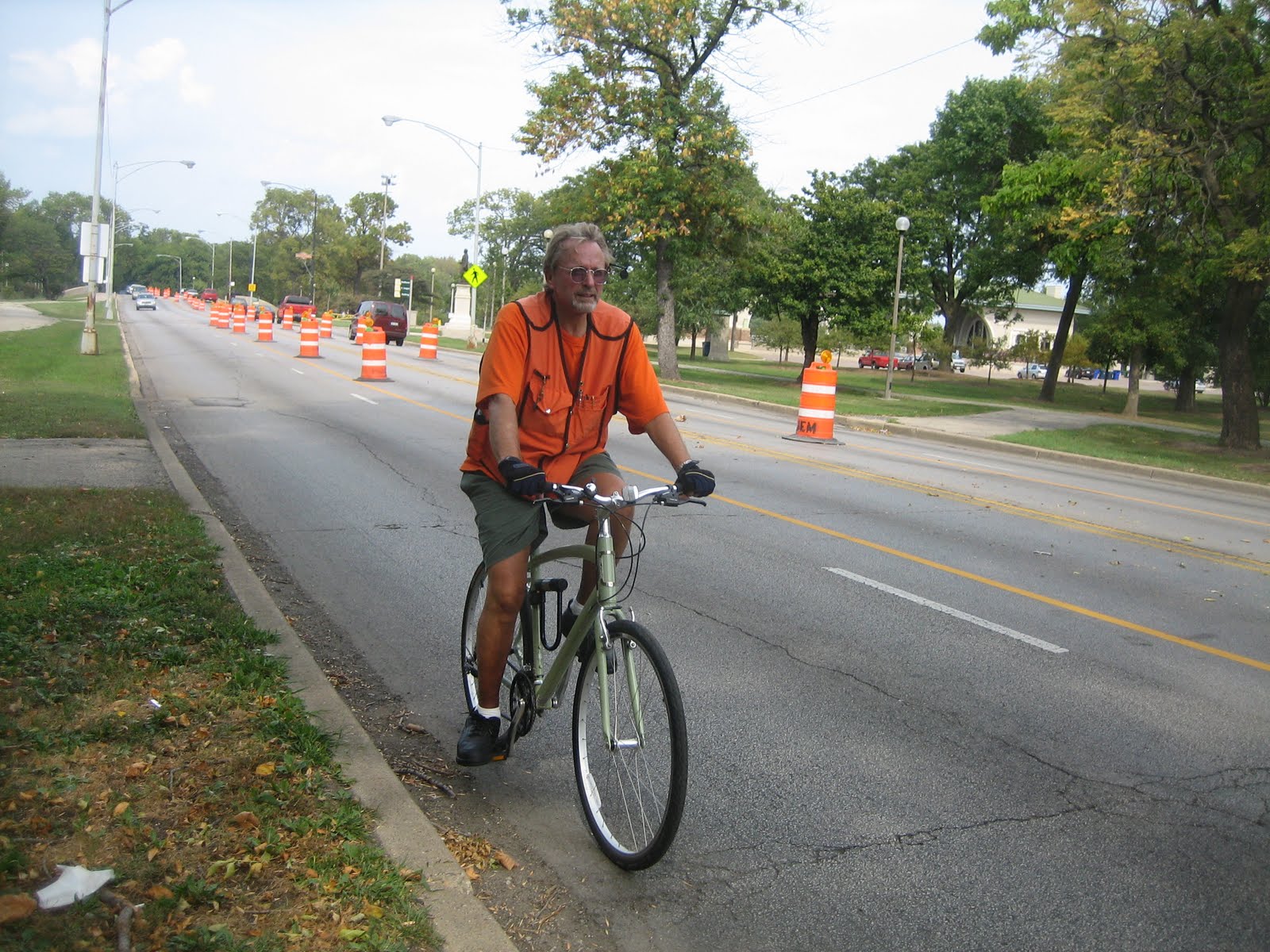
We continue north on the trail, then take another break on a path-side knoll. The New Belgium guys are exhausted and saddle-sore. “There are more fit people who work at New Belgium,” apologizes Brian. “They’re not all this lame.”


We’ve been using the Chicagoland Bike Map so far. Crossing the border into Wisconsin on the Kenosha County Trail we switch to the excellent Milwaukee and Southeastern Wisconsin Bike Map, available in Chicago at Boulevard Bikes. Just before the trail ends we zigzag into downtown Kenosha, the state’s fourth-largest city, on 93rd and 91st Streets and 7th Avenue.

We’re spending the night in a harbor-side motel in Kenosha, and that night I achieve a long-time goal: drinking at the Rendez’vous Tiki Lounge, 1700 52nd St. I’ve heard about the place from James Teitelbaum’s book Tiki Road Trip but never got to visit it on any of the occasions I passed through town because it doesn’t open until early evening.

The place doesn’t disappoint, with tasty Mai Tais and densely packed décor: classic faux-Polynesian mixed with pirate and punk rock elements. In addition to the usual grass mats, Easter Island heads, plastic sea creatures and ukuleles, there’s a large mural of a beach scene rendered in black and blood red, and skeletons and Jolly Roger flags abound.


The next morning the New Belgium guys are hurting from the miles. “I got a dino-sore in my pants,” says Brian. “A mega-sore-ass.” Andrew hires a cab to take him to Milwaukee with his bike, but the other guys decide to soldier on.

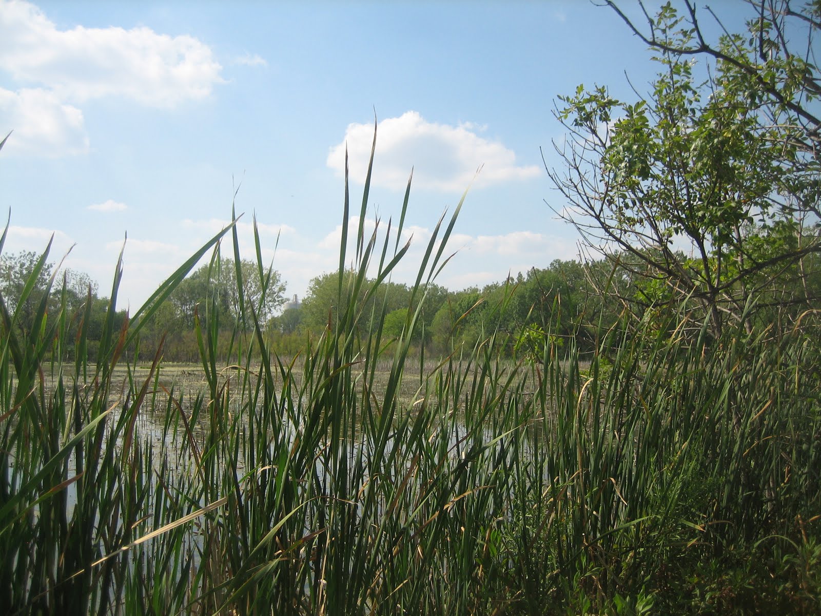
We head up a scenic lakeside path on the north side of town, then cut west to the northern section of the Kenosha County Trail. A woman is pedaling in the other direction towing a trailer with a dachshund and another mutt that looks like Benji.

Kenosha's lakeside bike path

Several miles later we enter Racine, the state’s 5th largest city, and pass by Frank Lloyd Wright’s famous Johnson Wax Building. Downtown we see a hundreds of people lined up outside the civic center. President Obama will be hosting a town hall meeting the next day and people have been lined up for tickets since 10:30 pm the previous night.


We take a break near the zoo on a cliff overlooking Lake Michigan. Nearby film crew shoots three cyclists in matching Lycra outfits for an episode of the local TV show “Discover Wisconsin.” A guys cruises by on the lakefront bike path on a giant ATB unicycle with knobby tires.

Heading west again, we pick up the north Racine Trail and take it for a half hour or so until it ends at Six Mile Road, six miles from downtown Racine. From there we get on Route 32 and enter the Milwaukee suburbs. At Ryan Road we head east and the north on 5th Avenue, quieter than the highway, which eventually takes us downhill to a pretty little waterfall.


We soon get on the Oak Leaf Trail, an undulating path through the forest along the lake south of Milwaukee, which eventually brings us into Milwaukee and affords a nice view of the city’s modest skyline. We meet up with Dave Schlabowske, the local bike coordinator, at the Palomino, 2491 S. Superior St., a southern-style restaurant and bar in the hip Bayview neighborhood on the south side of town.

Riding into Milwaukee on the Oak Leaf Trail

We take Kinnickinnic and 2nd St. downtown and I take the guys to their hotel, where their freaky, cowboy shirt-clad colleagues from New Belgium greet them. Later that afternoon the brewery hosts a reception for local beer distributors at Café Centraal, 2306 S. Kinnickinnic, a Belgian-style tavern. There I get to meet co-founder Kim Jordan, and thank her for the company’s $20,000 donation to West Town Bikes.

Chad with a New Belgian at Cafe Centraal

Afterwards the guys head to the Summerfest music festival on the lakefront. Before I join them I drop into the downtown Amtrak station to buy a bike box for my ride home to Chicago that evening, since I need to work the next day. I’m taking a midnight Megabus, since I’ve missed Amtrak’s last run for the day.

But when the Amtrak baggage agent hears I want the box in order to bring my bike on Megabus, whose cheap service to Chicago has cut into the rail company’s business, he refuses to sell me a box. I go back and forth with him for a while on this, then sneakily ask him to sell me a ticket for the morning train plus the box. “I’m not going to do that,” he says. “You’re just going to cancel your reservation and then ride the bus tonight anyway.”

I’m stymied. I can’t think of any way to convince this guy. Then it occurs to me to try anger. Fake anger, that is – while I often get annoyed, I almost never lose my temper. “This is very frustrating,” I say, banging my hand on the counter. “I’m a loyal Amtrak customer. If you guys had a late train I would take it. I just want to catch a little of Summerfest and go home, but because you’re being unreasonable I’m going to have to find somewhere to sleep here and then be late for work.”

“I spend a lot of money on Amtrak,” I say. “In fact, I’m taking the train again to La Crosse soon.” This does the trick. After he looks up my confirmation number for my next train-and-bike excursion, the Bars Across Wisconsin ride from the Mississippi back to Chicago, he sheepishly agrees to sell me a box.

I fold up the box and tie it to the back of my bike and then meet up with the New Belgium guys at Summerfest. A local beer distributor has gotten us VIP passes to, ironically, the Miller Beer Oasis. This gets us into a loft right above the stage for a set by Sound Tribe Sector Nine, a young band that plays techno-style music with live instruments. It’s exciting to be above the swarm of a thousand or two glow-stick toting fans, watching the octopus-armed drummer play hyperactive beats.

Sound Tribe Sector Nine

It’s time for me to head over to the Megabus stop, so the disarmingly touchy-feely New Belgium dudes thank me for getting them safely to Milwaukee and hug me goodbye. I pick up my ride from the attended bicycle parking lot and head a mile or two over to the bus stop. I tape the box together, take off my pedals and turn the handlebars and seal the bike inside.

Ironically, when Megabus shows up, the driver tells me he can’t fit my boxed bike in the cargo hold. I have to do some more negotiating, but finally convince him to throw my de-boxed bike on top of the other luggage. I fold up the box for my next bike adventure and climb aboard.

Saying "Ya" to Da U.P.

Andy Gregg at Lakenen Land

By John Greenfield

I’ve circled Lake Michigan by bicycle before, in stages, over a couple different trips. That’s the way I usually pedal around the perimeter of things, be it the state of Illinois or the continental U.S. (although I still have yet to ride the Eastern Seaboard from Key West, FL, to Bar Harbor, ME.)

I’ve ridden from Chicago to Milwaukee more times than I care to remember. In the late ‘90s I rode from the Windy City, via the east coast of Lake Michigan, to Marquette, MI, at the top of the Upper Peninsula, with my brother Dave in a 100-mile-a-day death march. And in 2007 I biked from Milwaukee to Marquette, completing the circuit.


Although I’d already ridden across the Upper Peninsula, I try not to miss opportunities to go bike touring with my dad Roy, 74. So when he and his riding buddy Toby, picked the U.P. as their next cycling destination, I decided to meet up with them. Also, the proposed route would zig where my previous route had zagged, so much of the ride would be terra nova for me.

The guys flew into Green Bay, pedaled partway up Wisconsin’s Door County peninsula and back, then rented a car in Packer City and drove to Escanaba, MI, where the high school mascot is the politically incorrect but linguistically amusing Escanaba Eskymo. From there they rode north across the U.P. to Lake Superior.

Meanwhile, I caught a red-eye Greyhound bus from Chicago up to Marquette, arriving to catch a glorious sunrise over Lake Superior. Marquette, the largest city in the U.P. at about 20,000, is a major port for shipping iron ore, and home to the University of Northern Michigan.

There I met up with my old friend Andy Gregg, who used to run Chicago’s Blackstone Bicycle Works community cycle center and now makes most of his living building unique furniture out of bicycle parts (www.bikefurniture.com). He’s responsible for the barstools made of wheel rims at the Handlebar bar and grill in Wicker Park. After his work was highlighted in a New York Times article, Andy enjoyed a major spike in business, including an order for 20 chairs from a Saudi sheik.

Andy Gregg in his studio

After a quick tour of his studio, including a ride on an old Schwinn Varsity Andy has set up as a ridiculously high-geared fixie, Andy rolls east with me along shimmering Superior shoreline for an hour or so until we reach Lakenenland, a crazy sculpture park created by retired steelworker Tom Lakenenen. It seems that the Marquette are has more than its fair share of eccentric artists working in metal.


Andy tells me that Lakenen started the project to keep himself busy after he quit drinking. The place is now populated by dozens of quirky large-scale sculptures, including skeletons, an alligator, a spaceship, a giant snowmobile and a T-Rex with a fishing pole. Many of the creatures have speech bubbles asking the local township authorities to stop harassing the artist – apparently he doesn’t have the proper permits for his park.


After Andy says goodbye, I continue east along the shoreline, passing through the town of Christmas with its towering Santa Claus billboards.


After pedaling about 40 miles I meet up with Dad and Toby on the main street of Munising, a city of 2,500 near Grand Island National Recreation Area and Pictured Rocks National Lakeshore, which is chock full of waterfalls.

Munising Falls

Unfortunately, the ferry to the island isn’t running, but we make an excursion to lovely Munising Falls, then hang out at a nearby beach where I lie on top of a picnic table and pass out for an hour, exhausted from my rough night on the bus. Then Dad and I pick up a whole smoked, locally-caught whitefish from a shack where men are smoking more fish while drinking cans of beer. We enjoy this delicious fish with Saltines and cheddar while watching the sunset over the bay.

We’d been planning to ride through Pictured Rocks to the town of Grand Marais but the highway we’d have taken is under construction. The guys instead decide to do a short day, riding on the highway directly to a tiny town called Seney, so I part ways with them to do a meandering route almost twice as long.

In Melstrand I make a quick pit stop at the Bear Trap, a tavern Andy recommended, full of taxidermy and tourists. Unfortunately it’s too early in the season for a pasty, the football-shaped, savory, meat-and-vegetable-filled pastry that is the national dish of the Upper Peninsula. It was originally brought to the U.P. by Cornish miners who brought it to work for lunch, reheating the pies on their shovels with their lanterns. Instead, I enjoy a Leinenkugel Creamy Dark.

The Bear Trap

After enduring a dozen miles on a torturous dirt road, I head south to meet up with the guys in Seney, an old railroad stop. It’s Friday, so we feast on a traditional fish fry dinner at Andy’ Seney Bar, the only place to eat in town. There’s fried perch, perch and smelt, all locally caught and damned tasty, baked potatoes, coleslaw and rolls, plus fruit jars of LaBatt beer.

The next day we roll southeast together towards the Lake Michigan coast, stopping in the unfortunately-named town of Germfask to pick up fresh bread, chocolate chip cookies and whoopee pies at a church bake sale, a benefit to send a local kid to Boy Scout camp. We picnic by a lovely little lake in the town of Curtis for lunch, then hit the coast and end our day in Naubinway, a little tourist town near the northernmost point of the Lake Michigan coastline.

There I finally get to eat my first pasty of the trip at a pizzeria. Although the waitress is apologetic about the quality, this food ball, smothered with gravy and served with slaw, tastes fine to me after a day of riding.


The following day of riding Highway 2 along the lakeshore provides great views, especially when I stop at rest stop a few miles east of Naubinway to bum around a boulder-strewn beach.


Along the way I pass many old-timey tourist stands selling the main elements of the U.P. diet: pasties, smoked fish, beef jerky, cheese curds, wild rice and fudge.


We spend the night in St. Ignance, near the five-mile Mackinac Bridge connecting the U.P. to the Lower Peninsula. This city of 2,600 on the Lake Huron coast was home to the St. Ignace Mission, founded by Jesuit priest and explorer Jacques Marquette. His gravesite is located at the former site of the mission, now the Museum of Ojibwa Culture, which also features recreations of a wigwam and a teepee.

In the morning we catch a gnat-infested ferryboat to Mackinac Island, about three miles long. It was an important site during fur-trading days, a British fort during the American Revolution, and the site of two battles during the War of 1812. Since there is little room for parking lots on this hilly little tourist haven, cars have long been banned and almost all business is conducted on foot, by horse and carriage, or on cruiser bikes.

Hotel porters on Mackinac Island's main street

We ride the eight-mile road around the perimeter of the island, a terrific car-free pedal.

Toby on the perimeter road

Since it was not quite the tourist season, life on the island is relatively relaxed and we’re able to find $30 hotel rooms. I explore some of the island’s rock formations, like Arch Rock and Skull Cave, then chill on the porch of the gigantic, white Grand Hotel, taking in the terrific cliffside view and sipping a Bell’s Big Porch Ale (brewed in honor of what’s supposed to be the largest porch in the world) while a jazz band plays. I take another solo spin around the perimeter of the island at sunset.


The next day the ferry takes us to Mackinaw City (note the different spelling but same pronunciation as the island) at the top of the Lower Peninsula, saving us from having to get a ride across the five-mile bridge, since it’s normally illegal to bike across. From there we wake our way around the west side of the northernmost lobe of the L.P. towards the Tunnel of Trees route, a historic one-lane road that hugs the coastline under a canopy of leaves.

Dad near Mackinaw City

We’re planning to have lunch at Legs Inn, a Polish restaurant in the tiny town of Cross Village. A few miles from town Dad’s shift lever for his rear derailleur busts, turning his 27-speed hybrid into a three-speed, but luckily the Legs Inn has some nearby cabins we can crash in for the night. In the morning Dad and Toby will head 20 miles east to rent a car to drive home to Pennsylvania.

The Legs Inn is an amazing place for several reasons. It’s a restaurant staffed by Poles from Poland in the middle of nowhere, serving excellent (if pricey) food to rival the best in Chicago’s Avondale neighborhood. Located on a bluff it offers a marvelous lakeside view from its patio. But the décor is truly unique.


The place was built in the 1920s by Polish immigrant Stanley Smolak with help from local Chippewa and Ottawa craftsmen. It reflects Smolak’s obsession with Native American culture and his own whimsical vision, with dozens of figures fashioned from driftwood, lake stones and other found materials, looking like something out of a Howard Finster painting. The place is named for the many upside-down cast-iron stove legs bolted to the roof for no apparent reason.


I say goodbye to Dad and Toby that night at leave the cabin at 5:30 am the next day to ride the Tunnel of Trees to Petoskey, where I’ll catch a bus home. The early morning ride on the car-less, green tunnel is surreal. I reach the city and pick up a bike box from Latitude 45, a bike shop which graciously had agreed beforehand to leave the box outside for me.

I have just enough time to box my bike at the nearby bus stop and hop aboard the Indian Trails bus, filled with Amish or Mennonite folks. I’m grateful to have an iPod with me for the ten-hour ride back to Chicago, after which I will have completed a circle around Lake Michigan once again.